
National nonprofit conservation organization American Forests (Website) was founded in 1875 with a mission to create healthy forests from coast to coast. The organization has just released a new Tree Equity Score map that analyzes tree canopies and access to trees in 486 municipalities across the country that have at least 50,000 people.
The Tree Equity Score considers factors like the existing tree canopy, population density, income levels, race, and age to create a single score between 0 and 100. Click HERE for the methodology behind it.
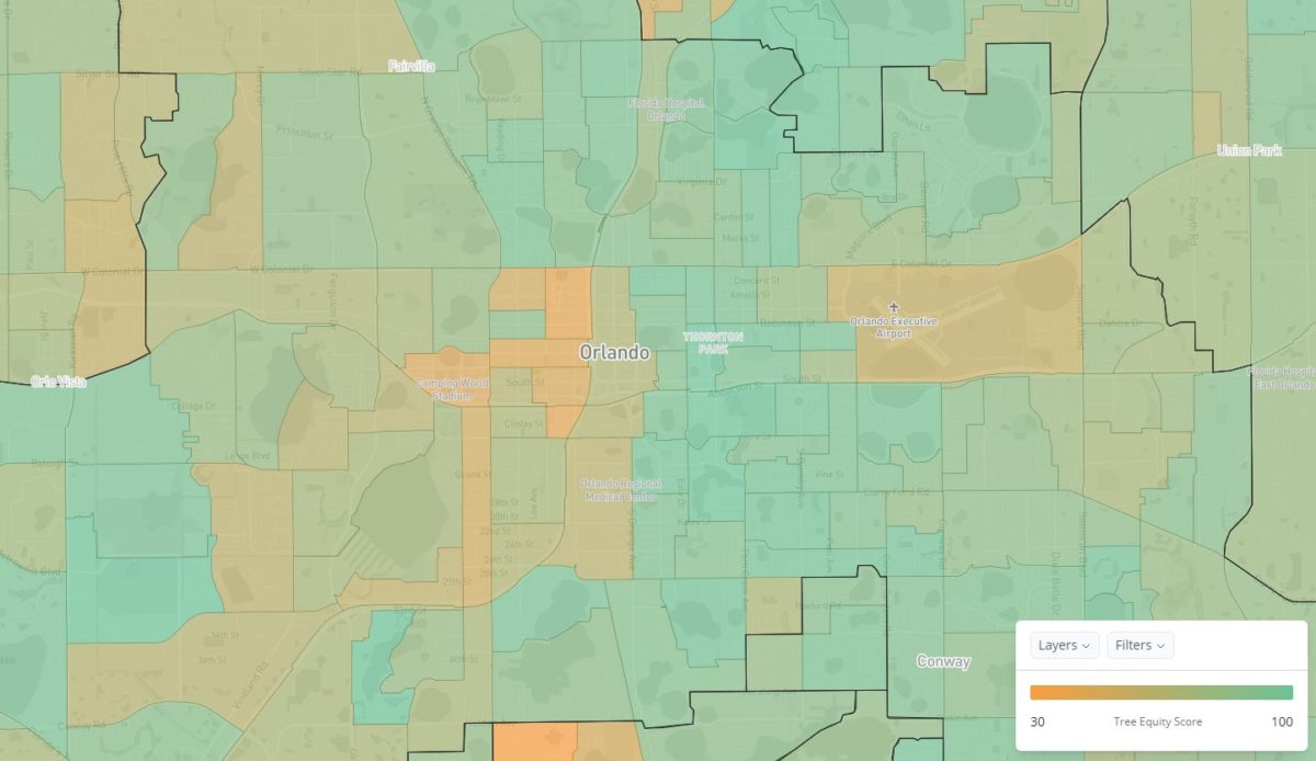
According to their findings, most wealthy, predominantly white neighborhoods have more trees than those that are more socioeconomically disadvantaged, dating back to redlining policies in the 1930s.
The term “redlining” refers to the practice of controlling where People of Color could live, by selectively raising prices based on race or ethnic composition. This tactic of racial segregation was practiced across the country in the early part of the century but largely abandoned.
Even the City of Orlando drew red lines over certain communities west of Downtown, namely in Parramore, as part of their “Negro Zones” initiative to control real estate values in the City Beautiful, which you can clearly see in the Tree Equity Score map.
The Tree Equity Score provides a narrative based on social equity in our urban areas that looks not simply at where trees are planted but at who is benefiting the most from them being there. Widely accepted benefits of urban trees include reduced air pollution, energy-saving, modifying local climate and mediating heat island effects, reduced noise pollution, and increased wildlife and plant diversity.
To see how Orlando measures up, or doesn’t, click HERE.