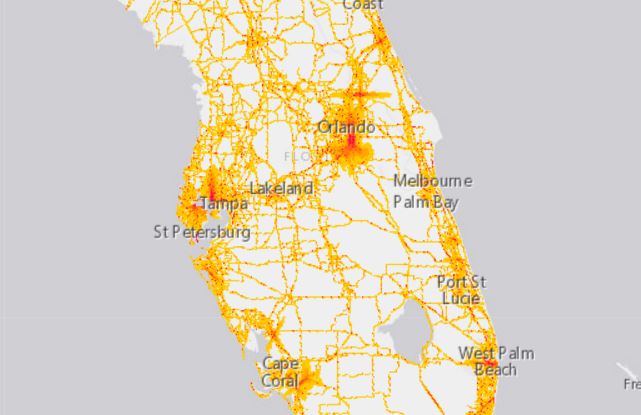

The National Transportation Noise Map tracks trends in transportation-related noise, including aviation and highway noise, and is part of the National Transportation Atlas Database (Website).
The data is hoped to aid policy makers when making decisions based on noise-related transportation investments.
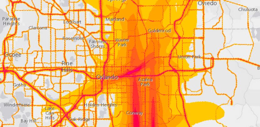
As seen in the map, there are clear red masses over Semoran and the Executive Airport due to flight patterns there. The interstate and major roads like Colonial Drive, Orange Blossom Trail, the 408, and Robinson Street are easy to make out as well.
To see the map, click HERE.